
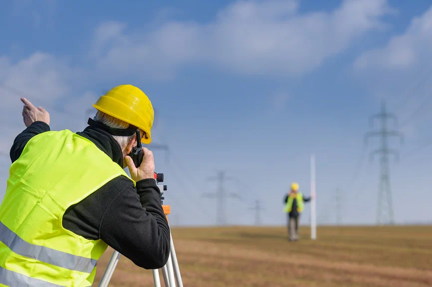
Topographic surveys allow a person to be aware of the physical characteristics of a piece of land. They give accurate data on elevations, contours, and natural or artificial features. The data are employed in construction, infrastructure growth, and environmental preservation. In Dubai, due to its ongoing urbanization, reliable land surveys must be conducted to facilitate safe and efficient development. topographic survey companies in dubai are responsible for gathering and interpreting such data to make it simpler for developers, engineers, and architects to make their decisions based on facts. These procedures assist in producing precise maps of the actual state of the ground. Construction works in the absence of these surveys may face unexpected setbacks, and therefore errors and delays that are costly.
- The Importance of Topographic Surveys to Construction: Topographic surveys form the basis of planning and constructional design. The surveys guide architects and engineers about how much a particular piece of land would be suitable for a particular building project. Topographic surveys establish the slopes, highland features, and those with older existing buildings within the land to find out how to best define foundations, drainage, as well as roadway layouts to cross the plot. The skyline of Dubai needs an accurate land survey to guarantee stability and longevity. The Dubai topographic survey companies help developers map risks such as instability in the soil, water collection, and below-ground obstacles. Without proper surveys, structures risk structural vulnerabilities, which result in safety issues.
- Importance of Surveys in Infrastructure Development: Dubai possesses one of the finest infrastructures worldwide in respect of roads, bridges, and tunnels. Every project involves substantial planning, from the beginning with the topographic survey. Engineers design favorable routes for roads, the best suitable locations for bridges, and the safest positions for mass transport systems based on information from a survey. In the absence of proper surveys, infrastructure development projects could develop problems in construction, such as traffic congestion or road damage in the long run. Topographic survey firms in Dubai ensure that infrastructure is constructed on a stable foundation, saving on maintenance and enhancing public safety.
- Urban Planning and Land Development: Urban planning is largely dependent on correct topographic information. In a rapidly expanding city like Dubai, city planners need to take into account the relationship of new buildings to old structures. A topographic survey offers critical information in planning residential, commercial, and industrial areas. A well-designed city has effective space utilization, better traffic movement, and better public amenities. Topographic survey firms in Dubai assist urban planners in preventing congestion, poor drainage, and uncontrolled growth. City planning without surveys can be haphazard, resulting in long-term inefficiencies.
- Land Disputes and Legal Boundaries: Land border conflicts are normal in real property and development ventures. A topographic survey gives actual boundary measurements to prevent property owners from engaging in clashes. In Dubai, where land is expensive, property lines must be precise for legal and financial assurance. Survey reports are official records that validate ownership of land and property dimensions. Dubai topographic survey firms utilize modern technology to create precise boundary maps, avoiding confusion and legal disputes. Without surveys, disputes over the land can result in delays in construction and loss of money.
- Role of Surveys in Flood Risk Assessment: Dubai possesses flooding and pooling sites of water. Topographic surveys assist in detecting such threats through the identification of low areas and natural drainage routes. These discoveries are useful when designing successful flood prevention mechanisms. Survey data is applied by engineers in the design of drainage systems, water diversions, and high-rise buildings. Construction can destroy property and pose safety risks if done without surveys. Topographic survey companies in Dubai prevent such hazards through proper land valuation.
- Significance in Mega Development Projects: Major schemes like airports, industrial estates, and business parks involve massive planning. A topographic survey is employed to gather important information to enable such schemes to be executed without a hitch. Survey maps are depended upon by engineers and planners to locate good spots for buildings, roads, and utilities. In Dubai, with large-scale projects being the norm, there is a crucial function that is fulfilled by Dubai topographic survey companies in making project delivery smooth. Without surveys, the projects can pose unforeseen challenges, leading to delays and cost overruns.
- Topographic Surveys and Soil Stability Analysis: Soil stability is a factor of great concern during land development and construction. A topographic survey helps to examine the composition of the land and identify weak points in the soil that can be reinforced if necessary. It is vital for the planning of secure and durable buildings. Dubai topographic survey companies help developers find such conditions beforehand to facilitate viable engineering solutions. The lack of accurate surveys can result in construction on unstable soil, leading to foundation failures and expensive repairs.
- Compliance with Government Regulations: Dubai has strict zoning and building regulations. Thorough land studies have to be undertaken by the authorities before any development project is initiated to ensure tight compliance with security and environmental regulations. The topographic survey is an obligatory part of such an approval process. Government officials use survey data to ensure that projects comply with legal standards. Developers who are not carrying out their surveys correctly risk delays, fines, and project cancellation. Topographic surveys in Dubai guarantee compliance with regulatory standards, leading projects smoothly to completion.
- Safety on Construction Sites: Topographic surveying helps determine hazards such as unstable land, underground utilities, and sloping ground. The removal of these threats early on enables engineers to design projects that incorporate worker and public safety. Without proper surveys, construction sites may be susceptible to accidents or building collapses. Dubai topographic survey firms have a responsibility to reduce such risks through proper land evaluation. By ensuring that projects will be built on stable and properly assessed land, the surveys enhance durability and long-term safety.
Conclusion
Dubai’s development standards require precise topographic data before construction approvals are granted. Authorities demand accurate land assessments to ensure that projects meet engineering, environmental, and safety guidelines. Developers must adhere to these topographic survey requirements to avoid legal and operational complications. If these requirements are not fulfilled, projects are declined, legal disputes are created, or costly adjustments are implemented. Topographic surveying ensures that all aspects of land development are thoroughly examined to finish projects successfully. By working in collaboration with talented experts, developers can ensure conformity and design green, well-planned structures.